I am now going to tell you about the hardest hike Brandon or I have ever done in our lives. It started when Brandon asked me where I wanted to travel to on the weekend of Sept. 16/17th. He gave me 3 different options to look into and decide between. I chose Fort William, Scotland for whatever reason and the planning begun. The area we went to is called "a hiker's Mecca." I had no clue what I was getting myself into!
We packed our bags and left for Scotland on Friday night. We did about 4 hours of driving, spent the night, and continued the drive on Saturday morning. We arrived in the Fort William area around noon. After stopping at a sporting goods store to purchase all the proper hiking equipment, we located the hike's starting point, parked the car, and began the hike at 2:00 pm.
Unfortunately, we already returned the library book about the hike so I don't know all the fun details like the elevation we climbed and the distance we hiked, etc. But my guess is that it was about 800 meters up (.5 miles or 2,624.67 feet.) I do know the hike we chose was rated "moderate/hard," the 4th hardest rating out of 5 and was supposed to take 6 hours to complete. (It took us 7.) It was recommended that if it was raining to NOT do the hike, and that only "well-equipped, fit hikers" should attempt our trail. I guess we thought we were up for the challenge and so it begun...
The first 7/8 of the way up the mountain was somewhat challenging, but pretty fun. There were times that Brandon was out of breath, but it was nothing he couldn't handle. (Haha, I'm so mean. And now you don't even know if I'm joking or not. You'll just have to ask him about it.) It wasn't until we reached the upper 1/8th of the mountain did things get really HARD. The book said that as you reached the top there would be "quite a scramble." (They love using that word in hike descriptions.) But we had no idea how intense of a scramble it was. At this point in the hike, there wasn't a given path or trail. It was more of a "choose your own adventure" to reach the top. There was zero indication of one route being easier or better than the other so we just randomly picked a path. And I forgot to mention that this scramble was not on the ground. There was no dirt involved. It was all very steep rock.
We will both admit, it was a little scary. You couldn't really look up at what you still needed to climb; you just needed to focus on where you were going to put your foot next without tumbling backwards down the 2,500 feet we had just gone up. There was a lot of prayer going through my mind and I specifically remember having this thought: "If my mom knew what I was doing right now... Boy, would she be _______." There were numerous words that came to mind to fill in the blank such as: worried, scared, upset, panicked, crying, etc. :)
What more can be said... We took one step at a time, went at a nice and steady pace, and eventually conquered the difficult task. When we reached the top, we both threw our arms up in the air and yelled "Wooooo, YEAH!" We were proud of the fact that 1) we were alive and 2) we were on top of a mountain in Scotland!
The pictures show our stopping point where we recuperated for 40 minutes or so. We then continued to a second mountain peak which was an hour's walk from the original peak, where we stopped for another 10 minute break. And then it was time to go back down...
If you're not aware, I hurt my knee last year when we hiked one of the tallest mountains in SoCal called Mt. Baldy. It hasn't fully recovered yet and I was nervous about how it would perform on this hike. Up to this point, my knee was perfect. No pain, no tightness, nothing.
However, I hadn't gone down the mountain more than 2 minutes before my knee started absolutely killing me. I was in excruciating pain and wasn't sure how I was going to make it down. It felt like my bones were rubbing against each other with each step I took. Basically, I just wanted to sit down and spend the night. Instead, I sucked it up and continued on to the only place I could go, down the mountain. We took lots of breaks, and we went at a pace I could handle. I often was going down on all fours or do a crawling technique to help reduce the pain. Plus, I know that the hiking pole did help a lot because I was able to put my weight on the pole instead of my knee. (Which explains why my upper body was so sore as well.) Once we made it through the steepest part of the decline, my knee loosened up a little and became more bearable. My theory is that the pain was so great that I eventually became numb to it or something. (That or God performed a semi-miracle.) Because somehow my condition improved just enough for me to keep going and not have a total breakdown.
Fast forwarding 2 hours, we made it to the bottom of the mountain. Hooray! It was now about 7-7:30 pm. We still had to go across the land a few miles to the road and then walk back 1 mile to the car. "Oh... flat land. That's not a big deal," you might be thinking. But in fact, this was probably the 2nd hardest part of the hike. The first being the scramble. The sun was going down and the darkness was coming. Our trail was taking us through swamps, muddy grass, and shallow rivers. Every minute that passed, we could see where we were going a little less. We were now booking it because we just wanted to be done. It eventually got very dark and we couldn't see anything. We knew we were going in the right direction, but we couldn't see where we were walking which provided a lot of hardships. The ground was by no means level; there were constant drop offs and holes. Brandon and I both fell or tripped 20 times. You'd be walking along, and all of the sudden you were in a river. Then, you were tripping as you went up onto dry land. Our shoes, socks, feet, and legs were soaking wet and extremely muddy. But we got to the point that we didn't care what we were stepping in, you just kept going. It was rough.
One time, I fell into a deep swamp and was stuck in the mud up to my knees! I let out a scream and Brandon stopped and turned around. He encouraged me with, "Come on, you can do it! Just pull yourself out." (Easier said than done.) I made it out fine and we kept going. Although, I almost lost my left tennis shoe to that swamp!
The road was finally in sight and hope was back in my heart. Not that we could see the road, but the cars' headlights indicated that we were getting close. We were worn out, very dirty, wet, hungry, and I was still in pain. As we approached the road, we just kept falling more and more. Every other step I was going all over the place. My arms were flailing in the air trying to keep my balance, and my body was getting tossed around left, right, up and down. My knee hurt so much and my legs were so tired that I felt I had lost all coordination and strength. We were about 10 feet from the road, and I started going hysterical. I'm not sure why exactly, but maybe it was out of joy that I knew we were almost there. I wasn't crying, I was actually laughing! I was laughing hysterically and I couldn't stop. Meanwhile, Brandon was just looking at me not really knowing how to respond. It went on for about 2 minutes before I pulled myself together and walked those final 10 feet.
My shoes hit pavement and I was the happiest girl in the world. We still had roughly a mile to walk to the car, but I didn't care. There would be no more falling and no more swamps. That's all that mattered. The walk along the road was easy in comparison and I was so ready to sit down that I was power walking/jogging the whole way.
We reached the car at 9 pm and the hike was over. WOW, what a day!
We drove back to the bed and breakfast, cleaned up, walked into town for some Chinese food for dinner, and went to bed. We were wiped out!
Now to some of you, the story I just unfolded might sound like a miserable day. And although it was a tough journey and we were exhausted by the end of it, we both had an absolute blast! It was a wonderful adventure and so much fun. I am glad we did it! My knee recovered in 5 days or so and it was totally, totally worth it. If you don't believe me, take a look at our pictures below and then maybe you'll understand. :)
(Part 2 of our time in Scotland will be next week. Cheers!)
Sep 29, 2006
Scotland is beautiful.
 The journey set before us. It looks a little intimidating. We're at the bottom looking at this mountain thinking, "We're going up that thing?!"
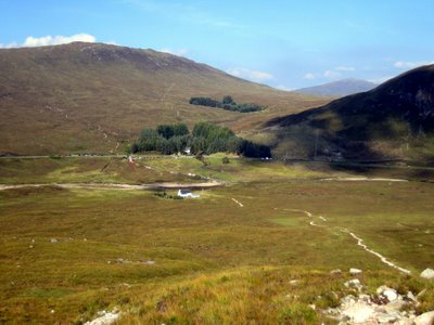
 Only a short while into the hike and already the ground level world seems so distant. If you enlarge the picture you can see the little cars. We parked in a lot right off the road, so you can see approximately where we came from.
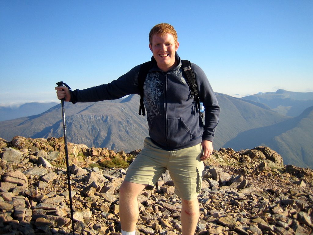
 Hiker pole in hand and ready to conquer the world... Actually, we were already taking a break! We had some shoes to tie and other business to take care of. (Hint: There are no public restrooms on the mountains.)


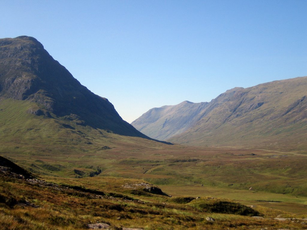 The journey set before us. It looks a little intimidating. We're at the bottom looking at this mountain thinking, "We're going up that thing?!"
 Only a short while into the hike and already the ground level world seems so distant. If you enlarge the picture you can see the little cars. We parked in a lot right off the road, so you can see approximately where we came from.
 Hiker pole in hand and ready to conquer the world... Actually, we were already taking a break! We had some shoes to tie and other business to take care of. (Hint: There are no public restrooms on the mountains.)
A lot of the hike was through big rocks (sometimes with a stream coming down them) like what is shown in this picture. Some of the time we were scrambling up little pebbles and other times we would face huge boulders that my legs could barely get over!
 Look how far we've come already! We're probably 1/3 way up at this point. From here until we reach the top, we didn't take anymore pictures (unfortunately.) The difficulty level continued to rise drastically and we were more concerned with surviving than capturing the moment. It's too bad you can't see what we actually climbed though. Or maybe it's best that you don't see it... for the worrying mothers out there. ;)
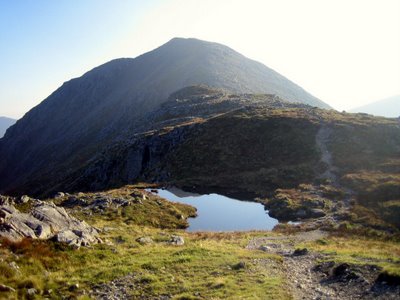
 Hooray, we've reached the top, (thank the good Lord) but haven't gotten to the very highest point quite yet. We're making our way across this ridge to where those other people in the photo are. Only then can we take a break.
 Victory is ours! We are pretty darn happy at this point. We can now rest our weary bodies and get some energy back. We were up there for a good 20-30 minutes before we continued on our way.

 Look how far we've come already! We're probably 1/3 way up at this point. From here until we reach the top, we didn't take anymore pictures (unfortunately.) The difficulty level continued to rise drastically and we were more concerned with surviving than capturing the moment. It's too bad you can't see what we actually climbed though. Or maybe it's best that you don't see it... for the worrying mothers out there. ;)
 Hooray, we've reached the top, (thank the good Lord) but haven't gotten to the very highest point quite yet. We're making our way across this ridge to where those other people in the photo are. Only then can we take a break.
 Victory is ours! We are pretty darn happy at this point. We can now rest our weary bodies and get some energy back. We were up there for a good 20-30 minutes before we continued on our way.


Our next destination was the highest spot on the peak in the distance.
 Wild grass colors and small bodies of water made the journey more interesting. I'm glad God mixed it up a little instead of just all green, flat terrain.
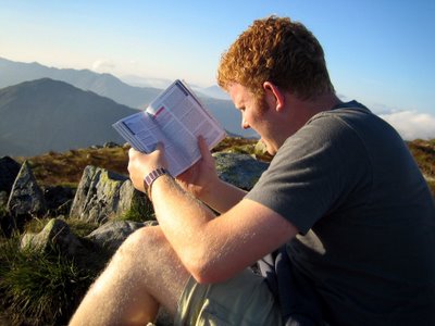
 Ahh... we arrived at peak #2 and took a nice little break. That's Brandon's typical squinty face as he attempts to read our hiking book. Heehee. :)
 Meanwhile, I got ahold of the camera before we began my least favorite part, the descent.

 Wild grass colors and small bodies of water made the journey more interesting. I'm glad God mixed it up a little instead of just all green, flat terrain.
 Ahh... we arrived at peak #2 and took a nice little break. That's Brandon's typical squinty face as he attempts to read our hiking book. Heehee. :)
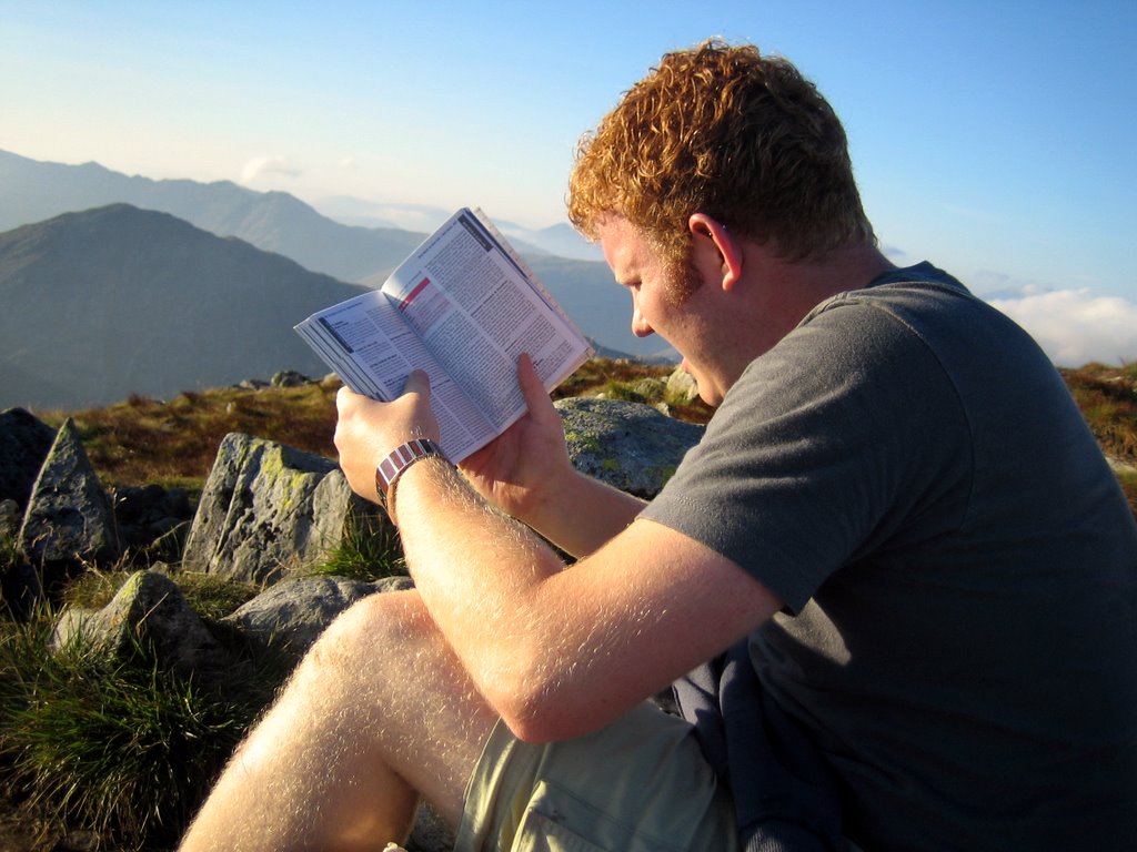 Meanwhile, I got ahold of the camera before we began my least favorite part, the descent.
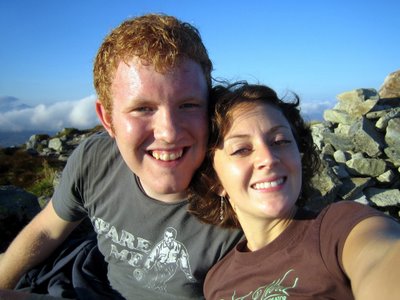
We're still smiling... that's a good sign!
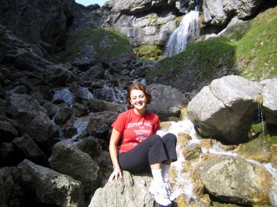
 Fun little waterfall along the way.
 Down, down, down we go.
 Hooray, we've reached the bottom; we now have a long stretch across and back to the car. This is when we were saying "Uh-oh, it's getting dark out. Pick up the pace!" Little did we know that shortly we'd be hiking in the dark for 30-45 minutes. Although, it felt like an eternity!!
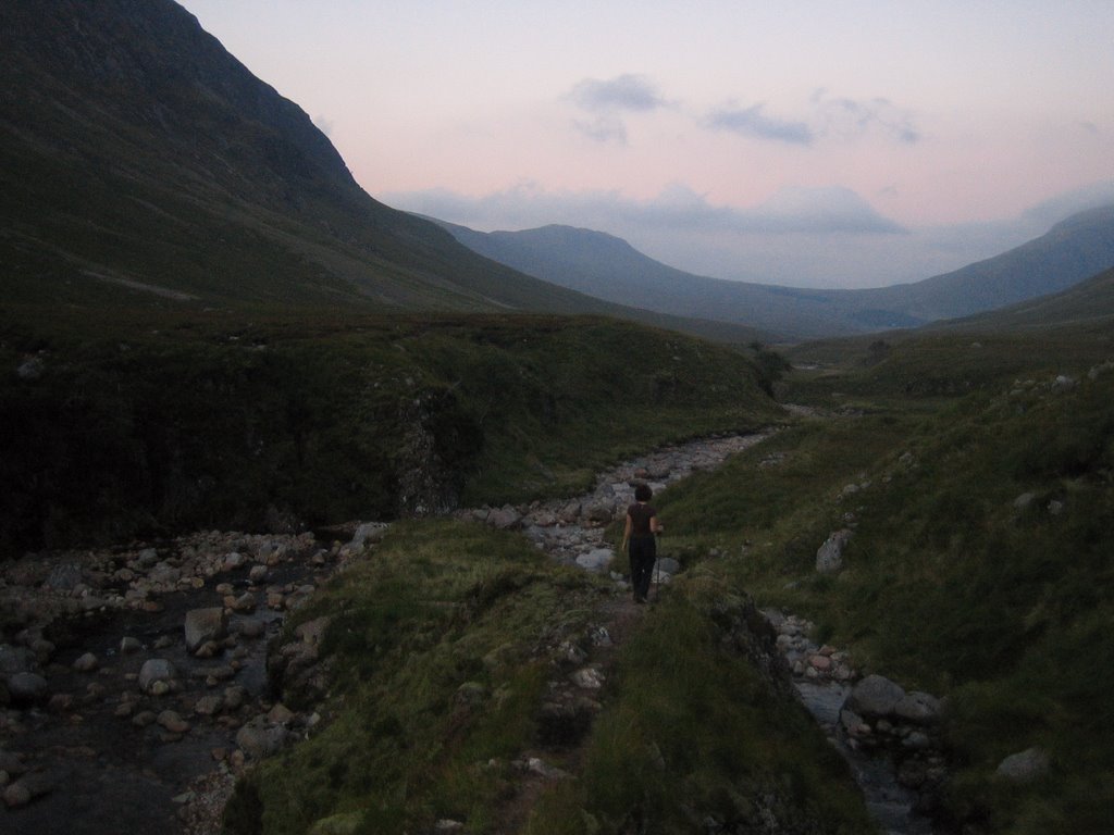
The Bed and Breakfast we crashed at... and I say crash because we literally hit the bed and were gone.
 The carpet was too much for me to handle. You can't get much more Scottish than that!
 Poor Brandon took a fall and there's his wound to show for it. As the saying goes, no pain, no gain, right? ;)
 Proof of the treacherous terrain of swamps and mud we trucked through for an hour. Are these not the nastiest socks you've ever seen in your life?!!
Sep 22, 2006
The moderate hike.
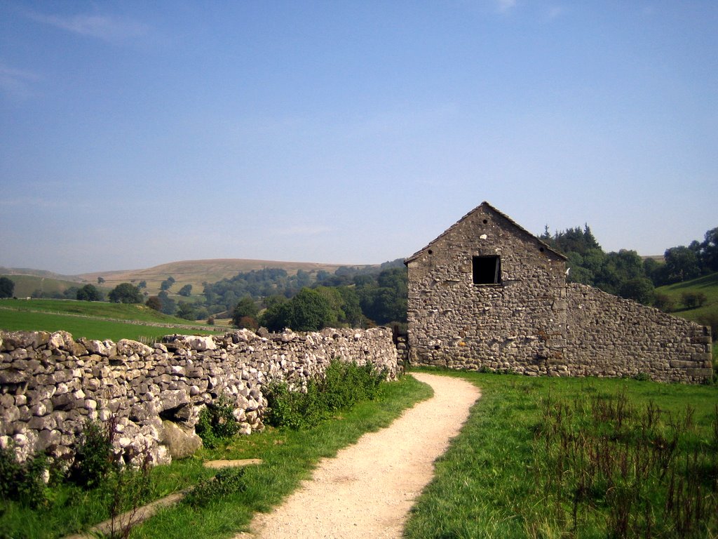
This is a local hike we did on September 10th, the weekend after we went to Spain. It was only a 45 minute drive to the location in the Yorkshire Dales and is known to be "one of the best day-walks in England, leading though dramatic limestone cliffs and gorges as well as flat moorland." Although, I got that quote off their website so I doubt they'd say it was one of the worst day-walks in England. :)
The hike was about 8 miles and is categorized as "moderate" in difficulty. It took us 3-4 hours to complete and we climbed an elevation of 350 meters which is 1,148.29 feet or .22 miles. For those that prefer to know the measurement in every other possible form, it was precisely 382.76 yards or 13,779.53 inches. This hike was nothing in difficulty compared to the hike we did in Scotland last weekend... which I'm glad I'm even alive to tell you about. ;) I am greatly anticipating blogging it next week and sharing our wild adventures with you.
Okay, back to our Sept. 10th hike. The first waterfall you'll see in the pictures is called Janet's Foss. Foss is the old Scandinavian word for waterfall. According to legend, Janet was the Queen of the local fairies, and lived in a cave behind the waterfall. The cave was formed by limestone bedrock being eroded by the water and re-deposited on mosses growing on the lip of the fall. That's where the name came from... if you were wondering.
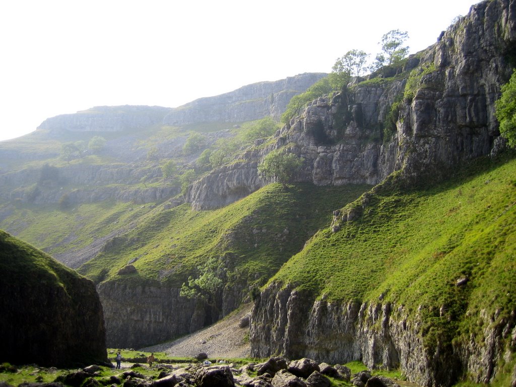
In the pictures, you'll see what I call the "climax" of the hike. It was the hardest part of the day and is described as: "a scramble which is difficult in places and should not be attempted unless you are a fit and experienced walker." In England, they call hikers, "walkers." It definitely doesn't sound as impressive or athletic! But anyway, you'll have to look at the pictures below to see if we made it through the scramble or not. For those that were unwilling or unable to get through the scramble there was an alternative, easier route.
It was a fun day and we were lucky enough to have fantastic weather.
If you're interested, you can go to this website and see the exact breakdown of our hike:
http://www.daleswalks.co.uk/walks/walk37/index.html
The hike was about 8 miles and is categorized as "moderate" in difficulty. It took us 3-4 hours to complete and we climbed an elevation of 350 meters which is 1,148.29 feet or .22 miles. For those that prefer to know the measurement in every other possible form, it was precisely 382.76 yards or 13,779.53 inches. This hike was nothing in difficulty compared to the hike we did in Scotland last weekend... which I'm glad I'm even alive to tell you about. ;) I am greatly anticipating blogging it next week and sharing our wild adventures with you.
Okay, back to our Sept. 10th hike. The first waterfall you'll see in the pictures is called Janet's Foss. Foss is the old Scandinavian word for waterfall. According to legend, Janet was the Queen of the local fairies, and lived in a cave behind the waterfall. The cave was formed by limestone bedrock being eroded by the water and re-deposited on mosses growing on the lip of the fall. That's where the name came from... if you were wondering.
In the pictures, you'll see what I call the "climax" of the hike. It was the hardest part of the day and is described as: "a scramble which is difficult in places and should not be attempted unless you are a fit and experienced walker." In England, they call hikers, "walkers." It definitely doesn't sound as impressive or athletic! But anyway, you'll have to look at the pictures below to see if we made it through the scramble or not. For those that were unwilling or unable to get through the scramble there was an alternative, easier route.
It was a fun day and we were lucky enough to have fantastic weather.
If you're interested, you can go to this website and see the exact breakdown of our hike:
http://www.daleswalks.co.uk/walks/walk37/index.html


AND WE MADE IT! I am glad to have gotten through the hard part.
 Looking back down at what we just climbed.
 The 2nd waterfall of the day. It was our reward for making it up the climb. :)
 Same waterfall, different view. I like how it flows perfectly out of the big opening in the rock. It looks like it was almost planned, not natural.

 Looking back down at what we just climbed.
 The 2nd waterfall of the day. It was our reward for making it up the climb. :)
 Same waterfall, different view. I like how it flows perfectly out of the big opening in the rock. It looks like it was almost planned, not natural.
The first thing we saw when we reached the top.
 The people at the bottom really put it all in scale. (You might have to click to enlarge the picture in order to see the people. They are really small.)
 Once we reached the very tip top the hike was quite easy. It was a straight, flat stretch for about 30-45 minutes before we headed back down. This is what the view was like at the top in all directions around us.
 We've now somewhat descended from the top and arrived at a lake called Malham Tarn. It is one of only two natural lakes in the Yorkshire Dales.

 The people at the bottom really put it all in scale. (You might have to click to enlarge the picture in order to see the people. They are really small.)
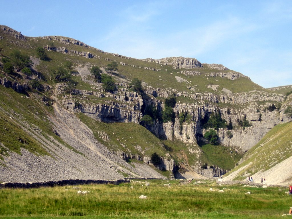 Once we reached the very tip top the hike was quite easy. It was a straight, flat stretch for about 30-45 minutes before we headed back down. This is what the view was like at the top in all directions around us.
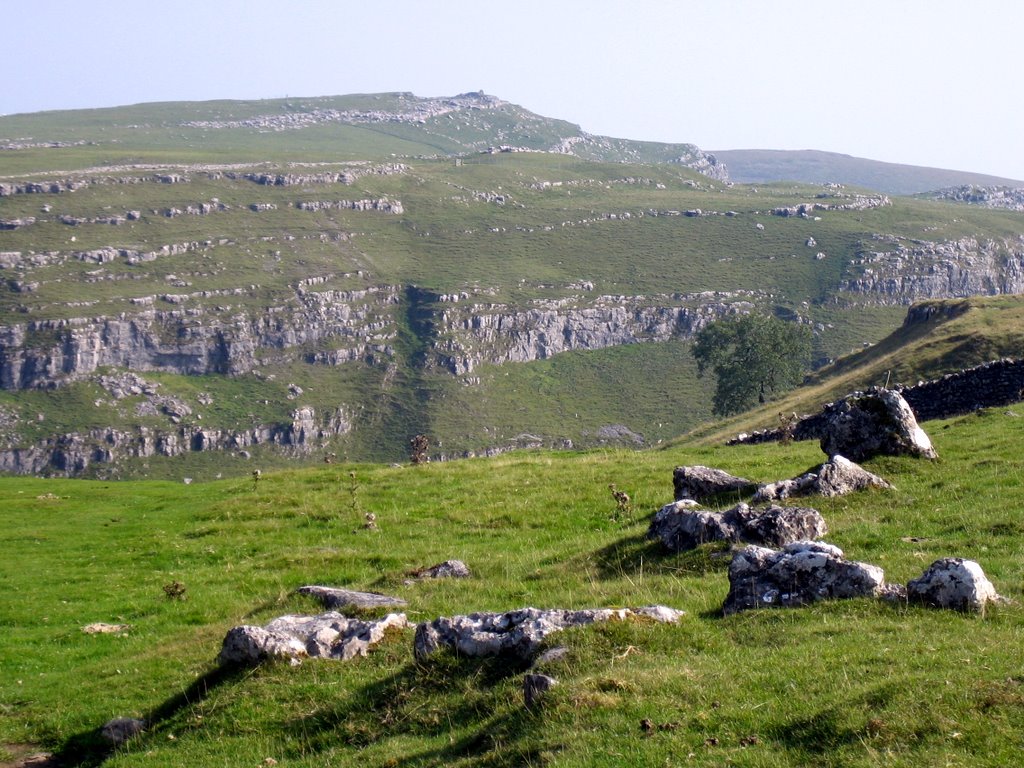 We've now somewhat descended from the top and arrived at a lake called Malham Tarn. It is one of only two natural lakes in the Yorkshire Dales.
Subscribe to:
Posts (Atom)

